Ivan Gayton is a senior Humanitarian Advisor with the Humanitarian OpenStreetMap Team (HOT). HOT uses ODK to help a global community map the places most vulnerable to disaster and poverty in order to support humanitarian aid and sustainable development.
Ivan started in the Geographic Information System (GIS) field while working in Haiti following the 2010 earthquake. Ivan and his team were trying to fight the ensuing cholera outbreak, but instead of getting rich geospatial data to decision makers, they were stuck fighting paper forms.
"Paper forms weren't working because floods were common in the camp."
The following year, Ivan encountered a similar situation in South Sudan during a mass displacement event. There was an urgent need for a better way to collect data on why mortality rates were so high. This time Ivan knew there was a better way. He worked with community members to setup ODK and immediately saw that the data collection was easier and more effective.
"We saw that data collection [with ODK] was much easier and much more effective."
Over the years, Ivan has come to depend on ODK for his geospatial data collection because of the power and flexibility the platform provides. He has now brought his years of experience collecting data to his work at HOT.
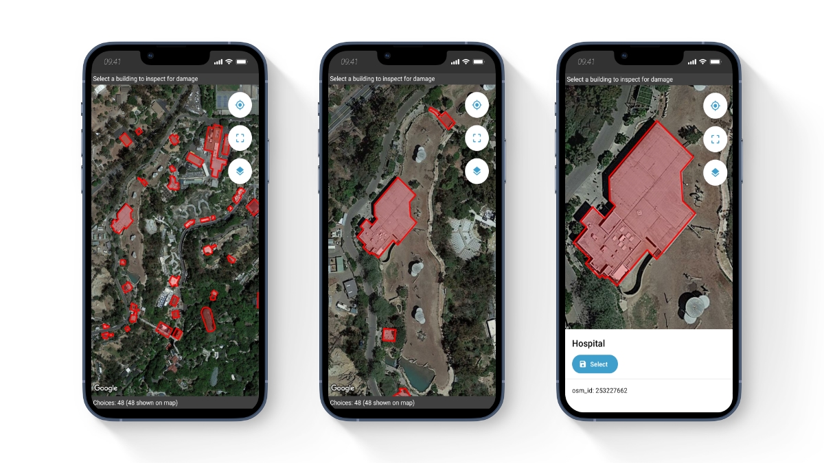
HOT enables a global community to map the places most vulnerable to disaster. When disaster strikes, thousands of volunteers, both on the ground and online, map areas that enable responders to reach those in need. Volunteers can simply open the ODK app, choose a location, and map critical infrastructure like buildings and roads. And because ODK is offline-first, no Internet is required to map.
Not only can volunteers add points to the map with ODK, they can also add lines and shapes. Metadata about map elements they select (e.g., building height) can be used in form skip logic. And if there is satellite imagery, those images can be included as offline layers to provide important context to make disaster response more effective.
Crises can happen anywhere, and when they strike, a good map can be the difference between life and death. For that reason, Ivan and the HOT community are on a mission to map the entire world. ODK is the platform they rely on to meet that mission.
ODK helps field teams be more effective with location-rich data.